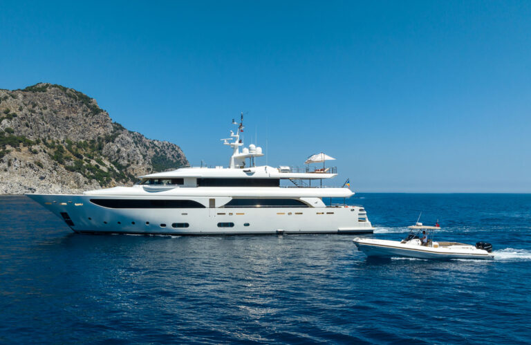
Greece accounts for roughly 40% of global summer motor yacht bookings, and in any given July the Mykonos roadstead proves it: a holding pattern of tenders, noise, and marina politics that has little to do with the reason most clients book a charter in the first place. The Cyclades extend another 120 nautical miles to the southwest, and the further you sail from the ferry lanes, the better the swimming, the cleaner the holding ground, and the quieter the evenings.
What follows is a practical account of seven islands that reward an itinerary built around water quality, anchorage comfort, and the kind of landscape that remains genuinely hard to reach without a vessel of your own.
The Wind Before the Islands
Any honest planning note on the Cyclades starts with the Meltemi. From late June through mid-September, a north-to-northwest gradient wind establishes itself across the central Aegean, typically running Force 4–6 and peaking at Force 7–8 during the sustained pulses that arrive in July and August. Episodes last two to five days before a brief lull. The islands below sit in the western and southern Cyclades, where the Meltemi curves slightly west of north; the lee sides of each island offer the most dependable anchorage relief during a blow.
June and September remain the most predictable months for extended passages. August is not impossible on a superyacht, but it requires a captain willing to wait out pulses and a programme with enough flexibility to hold an anchorage for 48 hours.
Milos
Milos is the westernmost inhabited Cycladic island of consequence for superyachts, sitting roughly 87nm southwest of Piraeus. The main port, Adamas, lies inside a volcanic caldera — one of the largest natural harbours in the Mediterranean — with depths of 4–8m and good shelter from the north. For guests, Adamas is a logistics stop: fuel, provisions, and a berth for the first night if arriving late.
The reason to come to Milos is the coast. Kleftiko on the southwest tip is an assemblage of white volcanic rock and sea caves accessible only by sea. Anchor in 5–8m over sand in settled conditions and land the tender directly into the cave systems. The bottom here is clean and the position is Meltemi-sheltered from the cliff face above. Sarakiniko on the north coast — smooth white pumice formations tumbling into bright water — is a day anchorage only, open to the north; it is best visited at first light before the day-tripper boats arrive from Adamas.
Milos repays a full circumnavigation. The south coast in particular holds a series of small coves accessible to shallow-draft vessels that are rarely visited. Allow two nights minimum.
Folegandros
Folegandros lies 25nm east of Milos and receives a fraction of the visitor traffic despite a Chora — the whitewashed hilltop town perched directly on the cliff edge at 200m — that is architecturally among the finest in the archipelago. There are no roads down to the main anchorage at Karavostasis from the Chora; guests who walk up in the evening will have it largely to themselves after 21:00.
For anchoring, Ormos Vathi (Agkali) on the southwest coast provides the most comfortable berth in prevailing summer winds: shelter from NW to E, sand bottom with reasonable holding, depths of 4–8m. A handful of tavernas operate on the beach with no infrastructure beyond them. In a strong Meltemi the gusts off the cliffs above become unpredictable; in those conditions, Karavostasis on the east side is the safer option, though more exposed to ferry traffic.
Folegandros is a single-night island for most programmes — long enough for the Chora and a morning swim, not so long that it exhausts its offer.
Sifnos
Sifnos is 18nm northeast of Milos and has a quieter reputation than its cooking deserves. The island has produced more professional chefs per capita than any other in Greece, and the tavernas here — particularly in Apollonia and around Vathy — reflect that. This is worth noting on a charter: crew welfare and guest dining ashore are both meaningfully better than on comparable islands.
Vathy Bay on the southeast coast is the preferred superyacht anchorage: a deep, almost circular inlet with 5–10m of water over sand, well sheltered from the north. The village of Vathy sits at the head of the bay; a single taverna operates at the water’s edge. Kamares, the ferry port on the west coast, is workable for provisioning and offers alongside berths for vessels up to approximately 45m, with depths of 4m at the quay.
Serifos
Serifos is 20nm north of Sifnos and rarely appears in charter itineraries, which is itself the principal reason to include it. Livadi, the main port, is a Meltemi-proof bay: well sheltered, depths of 4–6m, sand and weed bottom with adequate holding. The port is small and the quays are not equipped for very large vessels, but anchoring off with a tender run ashore presents no difficulty for yachts under 60m.
Above the port, the Chora sits at 230m on a cone of bare rock — visible from the water long before arrival. The walk takes 35 minutes from the quay. There is no particular commercial offer in the Chora; it is worth the climb for the position alone.
Serifos iron ore was mined commercially until 1963; the rusted loading infrastructure on the north coast of Livadi Bay is still standing and makes for an unusual backdrop. The island suits a half-day stop as part of a western Cyclades passage.
Antiparos and Despotiko
Antiparos is separated from Paros by a channel that runs southwest toward the uninhabited islet of Despotiko. The channel — navigable for yachts drawing up to 4m — provides Meltemi shelter and excellent holding in 4–9m over sand. The anchorage between Antiparos, Despotiko, and the small islet of Tsimintiri is one of the most protected in the southern Cyclades during a northerly blow and offers clear, flat water even when the open Aegean is running at 2m.
Antiparos town is 20 minutes by tender to the north: a compact Venetian kastro, a long sandy beach, and tavernas that operate at a pace appropriate to evenings afloat. Despotiko itself is uninhabited and holds the ruins of an ancient sanctuary to Apollo. The site is accessible and unstaffed; it rewards the curious with no queue.
This anchorage works particularly well as a staging point before or after Paros: close enough to access the provisions and infrastructure of Parikia, far enough to avoid the congestion.
Koufonisia
The small Cyclades — Koufonisia, Iraklia, Schinoussa, Donoussa — sit east of Naxos in a loose cluster, and Koufonisia is the most rewarding of them for a vessel capable of anchoring offshore. The island is flat and small (about 3.8 sq km) with water the colour more often associated with the Caribbean than the Aegean.
The main anchorage at Pori Bay on the north coast is semi-circular, well sheltered from the south, and holds 4–7m over sand. A narrow beach runs along the head of the bay with minimal development behind it. The port settlement on the south coast has tavernas, a bakery, and a small fuel dock, but the anchoring is done on the north side. Most charter vessels work the island as a day stop; arriving the evening prior and leaving after breakfast allows for the early morning light and a swim before the tripper boats arrive from Naxos.
Distances from Naxos Town: approximately 14nm east. Practical note: the northern anchorages are exposed to the south swell that occasionally wraps around in unstable weather; check the 24-hour forecast.
Amorgos
Amorgos is the easternmost of the main Cyclades, 45nm east of Paros, and the longest sailing passage in this list. That distance is also its primary protection. The island receives fewer transient charter vessels than any other on this route, and the anchorages at both ends reflect that.
Katapola, the western port, provides shelter from the Meltemi in a deep bay with two distinct anchoring options: Maltezi beach (northwest of the ferry quay, 4–7m, sand) in northerlies, and the inner bay southeast of the port in southerlies. Aegiali on the northeast coast is a second, smaller port with anchorage in 5–8m off the beach; it is more exposed to the north but offers a different character — a cultivated valley behind the bay, visible terracing on the hillsides, and very little vehicle traffic.
The Monastery of Hozoviotissa, built into the cliff at 300m above sea level on the island’s east face, is the single most architecturally specific landmark in the Cyclades. It is not visible from the water on approach; the hike from Katapola takes approximately two hours. The island was used as the principal location for Luc Besson’s 1988 film The Big Blue, and that association still drives a proportion of its visitors — though the underwater clarity that drew the production crew remains.
Amorgos justifies two nights: one at Katapola, one at Aegiali, with the circumnavigation of the south coast in between.
Planning Notes
Charter season: June and September offer the most consistent conditions. July–August is viable on a motorised superyacht with the flexibility to hold anchorage during Meltemi pulses.
Fuel and provisioning: Adamas (Milos) and Katapola (Amorgos) are the most reliable provisioning stops on the western and eastern ends of this route respectively. Sifnos (Kamares) and Antiparos Town cover the middle section. Koufonisia and Folegandros have limited supply infrastructure.
Itinerary note: A seven-night charter departing Athens can cover Milos, Folegandros, and Sifnos with time to spare. Extending to Amorgos and Koufonisia requires ten nights or a programme that prioritises sailing over stops. ADY has built itineraries on this route since the 1970s and can advise on the sequencing in detail.
The islands above are not undiscovered. They are simply less convenient than Mykonos by ferry, which is the only reason they remain manageable by sea.